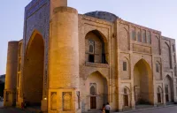
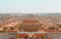
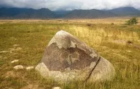
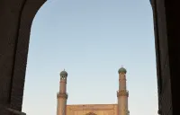
Places to visit

Filter by country

Pokhara NP

The first settlement of the valley is theorized to have taken place when the first King of Kaski, Kulamandan Shah Khad made Batulechaur in the northern side of the valley his winter capital during the mid 14th century. 

Pokhara is the leader adventure and leisure destination in Nepal, a gateway for nature lovers in the Annapurna region with plenty of entertainment.

In Pokhara you can experience the excitement of adventure: boating, hiking, pony rides, paragliding, bungee, zipline or simply relaxing at one of the several lakes in the valley. 

Pokhara will overwhelm you with its natural beauty and great photo ops. Walk along the shores of the Fewa (Phewa) Lake, enjoy the greenery surrounding you and gaze at the spectacular panoramic view of the Himalayan peaks of the Annapurna Massif. Brightly painted wooden boats add vibrant colors to the greenery, while paragliders float down slowly from above. Flying over the lake is probably going to be one of the highlights of your travel experience in Nepal.

Pokhara is the starting point for Lumbini, the Annapurna circuit, for the upper Mustang, for the Manaslu, Jomsom, Muktinath, the Chitwan natural park and more.

Ismoil Somoni Peak TJ

Located in Tajikistan, in the Pamir Range, at an altitude of 7,495 meters, Somoni Peak is the highest peak in the country and Central Asia and the highest mountain in the former Soviet Union. It is a mountain of gigantic dimensions that appears surrounded by numerous glaciers. It is located at the confluence of the "Academy of Sciences" and "Pierre le Grand" chains.
Until 1933 it was known as Mount Garmo, then Stalin Peak until 1966, before it was renamed Communism Peak until 1998.

Sary-Tash KG

Small village of yak breeders, located at the crossroads with China and Tajikistan on the Silk Roads. Sary Tash means in Kyrgyz "the yellow stone". From the village, there is a panoramic view of the Zalaïskiy mountain range. To the west where the waters of the Kyzyl-Suu river flow towards Djirgatal in Tajikistan, we can see the Lenin peak rising to 7134 meters above sea level. To the east, the road leads to Kashgar, following the Zalayskiy chain and dozens of peaks over 5,000 meters, and peaks over 6,000 meters, such as Zaraya Vostoka, which marks the border with Kyrgyzstan, China and the Tajikistan, and culminates at 6349. But in front of you, you find the reason why the river is called Kyzyl-Suu or "red water", the peak Korumdu culminating at 6614 meters of altitude lets flow from its massif of red waters.

Fortress of Hissor TJ

Hissor (or Hissar, Gissar) is situated 27 km southwest from Dushanbe and 8 km south from Hissor city is one of the main historical site of Tajikistan and includes : Hissar fort with ark built in XVI century; the Registan square; old madrassah-i Kuhna built in XVI century and its museum and another madrassah built in XVIII century; a caravanserai built in 1808; the mosque Sangin; the mausoleum of Mahdumi Abzam built in the XVI century, over the grave of Khdja Muhhamad Haivoki.

Hissor fortress was  the residence of the Governor of Emir Ibrahim Bey until 1924, when he was defeated by the red army. The fortress walls were 1 meter thick and protecting a palace, terrace, a garden and a water pool, but today we can see only the monumental gates built of burnt bricks with two cylinder towers and lancet arch between them. This type of architecture is typical for most of Bukhara buildings built within XVIII-XIX cc. 

The fortified complex has undergone various reconstructions, renovations and additions. Historical documents indicate a fort in Hissor as early as 1000 BC, other records of the fort relate to the time when Cyrus the Great founded the first Persian Empire (around 550 BC).


Dzungarian Alatau KZ

The Dzungarian Alatau, also known as the Dzungarian Range, is a mountain range located in Central Asia. It extends through the territories of Kazakhstan, China, and Mongolia. The name "Dzungar" comes from the name of the ethno-cultural group that lived in these areas.

The Dzungar Alatau is a part of the Tien Shan mountain system, which includes several ridges and mountain ranges. This range is characterized by beautiful landscapes, including high mountain peaks, deep gorges, glaciers, and mountain rivers.

The Dzungarian Alatau region is a natural refuge for a variety of plants and animals, including snow leopard, mountain sheep, ibex and various bird species. It is also home to a variety of ecosystems including forests, grasslands, and alpine pastures.

Dzungarian Alatau attracts tourists and outdoor enthusiasts with its climbing, hiking, trekking, climbing and snow sports. The region is also rich in cultural heritage and historical sites connected with the peoples living in the area.

The Dzungarian Alatau is a unique and beautiful mountainous area with rich biodiversity and opportunities for outdoor activities, making it a popular destination for tourism and nature exploration.

Charyn canyon (Sharyn) KZ

Charyn Canyon is a picturesque deep gorge in Kazakhstan, stretching for 154 km along the Charyn river valley, not far from the border with China and Kyrgyzstan. The dried up bed of the ancient river, a unique natural monument, more than 12 million years old, fascinates with its cosmic landscapes. Given the size and geological features of the Charyn Canyon, it is often referred to as the "younger brother" of one of the largest gorges of the planet: the American Grand Canyon. We can also observe a Relic Forest of ash tree. Reddish cliffs and abysses that are similar to castle towers, depths from 150 to 300 m, impress everyone who has been here. The most visited and famous is the site of the canyon, called the "Valley of Castles". Enjoy a walk along a narrow valley with fantastic-shaped walls.

It was declared a protected reserve in 1964 and today intagrated in the Charyn National Park.

Jizzakh UZ

Jizak (or Jizzax / Jizzakh) is the administrative center of the Jizzakh region, a city of regional subordination of 180,000 inhabitants. A major transport hub, economic, scientific, educational and cultural center of the region. Located on the highway between Tashkent and Samarkand. It is also connected to these towns by a railway line. It is located on the northern foothills of the Nuratau Ridge, on the Sanzar River, in the southern part of the Mirzachul Steppe. It was founded in the 10th century, in an oasis rich in vegetation, as an important transit point on the Great Silk Road. The section of the Ustrushana trade route, passing through Jizzakh, was one of the most important on the entire stretch of the Silk Road.

Join us on Facebook!

And keep updated with our tour promotions, or follow us on